Safe Routes In Action
See Safe Routes in Action
Countermeasures are categorized by the four tiers of the Safe System Roadway Hierarchy which characterizes engineering and infrastructure-based countermeasures and strategies relative to their alignment with the Safe System Approach.
The Safe System Approach, by the U.S. Department of Transportation is rooted in the idea that transportation infrastructure should be proactively designed and managed to prevent fatal and serious injury crashes, minimizing physical harm when mistakes happen.
Remove Severe Conflicts
Removing severe conflicts involves the elimination of specific high-risk conditions. This involves separating road users moving at different speeds or different directions in space to minimize conflicts with other road users.
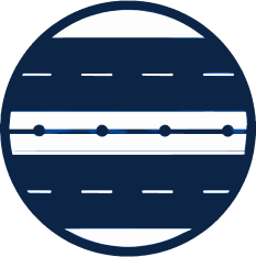
Bicycle Lanes
# of uses in NHV: 35+ miles- Crescent Street
- Edgewood Avenue
- Grove Street
- MLK Boulevard
- Norton Street
- South Orange Street
- Water Street/Vision Trail
Nearly one-third of these crashes occur when motorists are overtaking bicyclists; because the speed and size differential between vehicles and bicycles can lead to severe injury. Many people are not comfortable riding a bicycle because of their fear that this type of crash may occur. Providing bicycle facilities can mitigate or prevent interactions, conflicts, and crashes between bicyclists and motor vehicles, and create a network of safer roadways for bicycling.
Median Barriers
# of uses in NHV: <5- Fountain Street b/w McKinley Avenue and Forrest Road
- Whalley Avenue b/w W Rock Avenue and Jewell Street
Median barriers are longitudinal barriers that separate opposing traffic on a divided highway and are designed to redirect vehicles striking either side of the barrier. Median barriers significantly reduce the number of cross-median crashes, which are attributed to the relatively high speeds that are typical on divided highways.
Medians and Pedestrian Refugee Islands
# of uses in NHV: <5- South Orange Street @ South Frontage Road
- Union Avenue @ W Water Street
A median is the area between opposing lanes of traffic, excluding turn lanes. A pedestrian refuge island (or crossing area) is a median with a refuge area that is intended to help protect pedestrians who are crossing a road. Installing a median or pedestrian refuge island can help improve safety by allowing pedestrians to cross one direction of traffic at a time.
Road Diets
# of uses in NHV: <5- Ella T. Grasso b/w Plymouth Street and Lamberton Street
- Long Wharf Drive
- State Street
- Whitney Avenue
A Road Diet, or roadway reconfiguration, can improve safety, calm traffic, provide better mobility and access for all road users, and enhance overall quality of life. A Road Diet typically involves converting an existing four-lane undivided roadway to a three-lane roadway consisting of two through lanes and a center two-way left-turn lane. A Road Diet can be a low-cost safety solution when planned in conjunction with a simple restriping and signage plan, and often can be accomplished at minimal cost.
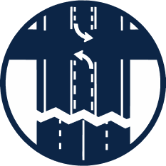
Traffic Circles/Rotaries
# of uses in NHV: 10+- Chapel Street @ Yale Avenue
- Crescent Street @ Munson Street
- Elm Street @ W Park Avenue
- Quinnipiac Avenue @ Ferry Street
- Sea Street @ Harbor Close
- Woodward Avenue @ Hervey Street
- Woodward Avenue @ Tuttle Street

Traffic circles are round and sometimes landscaped concrete medians placed in the center of intersections that require all traffic traverse the intersection in a circular motion. Creating a uniform path of travel for all movements (whether turning right, left, or traveling straight), this reduces the number of potential conflict points and creates a calmer, more predictable intersection.
Reduce Vehicle Speeds
Speed plays a critical role in the cause and severity of crashes. There is a direct correlation between higher speeds, crash risk, and the severity of injuries. Excessive travel speeds pose disproportionate safety risks for people that travel by bike or on foot, and sharing the road with cars that travel at higher speeds discourages people from bicycling. Implementing design features and speed management strategies to reduce vehicle speeds effectively reduces the kinetic energy involved in a crash should it occur.
The most common design element to deter speeding that has been used on residential streets over many decades is the speed hump. But speed humps are just one tool in the toolbox and may not always be the best solution to achieve the desired traffic calming and speed reduction outcomes.
Chicane/Pinch Point
# of uses in NHV: 2- Derby Avenue @ George Street (quick build)
Chicanes (pronounced “chick-ain”) introduce mid-block elements such as medians and sidewalk extensions on low volume streets that curve and sometimes narrow the path of travel for traffic. This requires drivers to be more attentive of their surroundings by eliminating an unobstructed straight line of travel. Chicanes may also include amenities such as benches, bicycle parking, or plantings. Chicanes can also provide opportunities for new street trees, which have a demonstrated complementary traffic calming effect.
Curb Extensions
# of uses in NHV: 54+ Intersections- Congress Avenue (John C. Daniels School)
- Derby Avenue @ George Street and Norton Street (quick build)
- Winthrop Avenue @ Goffe Terrace
Curb extensions extend the width of the sidewalk at intersections. This reduces the overall crossing distance and exposure to vehicular traffic for pedestrians. By physically narrowing the roadway, this requires more careful and slower turning movements from cars at intersections for increased safety. They are also good opportunities to add green infrastructure and landscaping for both stormwater retention and beautification.
Speed Humps
# of uses in NHV: 60+- Wooster Street (at the Arch)
Speed humps are mid-block paved asphalt “humps” on low volume streets that aim to reduce vehicle speeds by 15 to 20 mph on one-way or two-way roads. Speed humps are commonly two to four inches high and 12 to 14 feet wide, with a ramp length of three to six feet depending on the target speed of the roadway. They are accompanied by a warning sign.
Speed Safety Cameras – Coming Soon
# of uses in NHV: 8- Blatchley Avenue
- Derby Avenue S. Frontage Rd and Park St
- Fountain Street
- George Street and Rev. MLK Jr. Blvd and Church street
- Kimberly Avenue
- Route 80
- Sherman Avenue
- Townsend Avenue
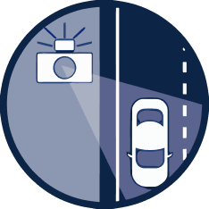
Speed Safety Cameras (SSCs), or automated speed enforcement systems, use speed measurement devices to detect speeding and capture photographic or video evidence of vehicles exceeding a set speed limit, serving as a tool to enforce speed limits and improve road safety.
Speed Table/Raised Intersection/Raised Crosswalk
# of uses in NHV: <10- Along Long Wharf Drive (raised crosswalks)
- Farnham Avenue @ BOMUS (raised crosswalk)
- Orange @ Audubon (raised intersection)
- Sargent Drive (speed table)
- Townsend Avenue - Nathan Hale School (raised crosswalk)
- York Street - Alexander Walk along Long Wharf Drive (raised crosswalks)
- York Street - Library Walk (raised crosswalk)
Speed tables are mid-block, vertical traffic calming devices, essentially flat-topped speed humps, designed to slow down traffic by raising the entire wheelbase of a vehicle. They are longer than traditional speed humps and allow for higher speeds than humps while still effectively reducing traffic speeds. Feature a flat rather than rounded surface, speed tables can integrate crosswalks or be applied to an entire intersection. Raised crosswalks simultaneously encourage drivers to yield to pedestrians in the crosswalk.
Manage Conflicts in Time
Managing conflicts in time assumes that users will need to occupy the same physical space on the roadway but creates a safer environment by separating the users in time using traffic control devices, such as traffic signals or hybrid beacons, to minimize vehicle conflicts. Providing discrete and alternating opportunities for users to navigate the roadway environment is not only a safety strategy, but also one that relates to user comfort and convenience, especially for non-motorized users.
Leading Pedestrian Interval
# of uses in NHV: 13- Chapel Street and College Street
- Chapel Street and Dwight Street
- Chapel Street and High Street
- Chapel Street and Park Street
- Chapel Street and York Street
- Crown Street and High Street
- Crown Street and Park Street
- Crown Street and York Street
- George Street and Dwight Street
- George Street and Howe Street
- George Street and Park Street
- Sherman Avenue and Rev. Dr. Martin Luther King, Jr. Boulevard
- Sherman Avenue and South Frontage Road
- Winchester Avenue at Munson Street
Leading Pedestrian Intervals (LPIs) typically allow pedestrians a 3-7 second “head start” to cross the street before the signal turns green for vehicles traveling in the same direction or turning onto an intersecting street. This strategy improves pedestrian visibility, and reinforces the pedestrian right-of-way during a walk signal. According to the FHWA, LPIs result in a 13% reduction in pedestrian-vehicle crashes.
Red Light Safety Cameras – Coming Soon
# of uses in NHV: 11- College Street and George Street
- Ella T. Grasso Blvd (Rt 10) and Derby Avenue (Rt 34)
- George Street and Rev. MLK Jr. Blvd and Church street
- I-95 S off-ramp/Main Street Annex and Woodward Avenue
- Orange Street and Edwards Street
- Prospect Street and Highland Street
- Quinnipiac Avenue (Rt 103) and Foxon Blvd (Rt 80)
- Quinnipiac Avenue and E. Grand Avenue
- Whalley Avenue (Rt 63) and E. Ramsdell Street/Ramsdell Street
Red Light Safety Cameras, also known as automated enforcement systems, are cameras that detect and record vehicles entering an intersection after the traffic light has turned red, and are used to issue citations for red-light running violations.
Yellow Change Intervals
# of uses in NHV: 11- At red light camera locations
At a signalized intersection, the yellow change interval is the length of time that the yellow signal is displayed following a green signal indication. The yellow signal confirms to motorists that the green has ended and that a red will soon follow. Since red-light running is a leading cause of severe crashes at signalized intersections, it is imperative that the yellow interval be appropriately timed. Too brief an interval may result in drivers being unable to stop safely and cause unintentional red-light running. Too long of an interval may result in drivers treating the yellow as an extension of the green phase and invite intentional red-light running.
Increase Attentiveness and Awareness
Increasing attentiveness and awareness involves alerting roadway users to certain types of conflicts so that appropriate action can be taken consistent with the Safe Streets Approach.
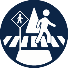
Crosswalk Visibility Enhancements
# of uses in NHV: TBD- Farmington Canal crossings (going to bid spring), TBD
Three main crosswalk visibility enhancements help make crosswalks and the pedestrians, bicyclists, wheelchair and other mobility device users, and transit users using them more visible to drivers. These include high-visibility crosswalks, lighting, and enhanced signing and pavement markings. These enhancements can also assist users in deciding where to cross.
Dynamic Speed Feedback Signs
# of uses in NHV: <5- Chapel Street (b/w Olive Street and Franklin Street)
- State Street (b/w James Street and Edwards Street)
Dynamic speed feedback signs (DSFS) are traffic control devices that provide a message to drivers when they exceed a certain speed threshold. A DSFS system typically uses a speed measurement device and a message sign to display feedback to drivers. DSFSs may be used in various applications such as school zones and work zones.
Longitudinal Rumble Strips
# of uses in NHV: N/A- I-91
- I-95

Longitudinal rumble strips are milled or raised elements on the pavement intended to alert drivers through vibration and sound that their vehicle has left the travel lane. They can be installed on the shoulder, edge line, or at or near the center line of an undivided roadway.
Rectangular Flashing Beacons (RRFB)
# of uses in NHV: 30+- Audubon Street
- Canal Street @ Lock
- Clinton Avenue
- Court Street @ Olive
- Crescent Street @ Munson Street
- Lock Street @ Canal
- Long Wharf Drive crosswalks
- York Street-Alexander Walk
RRFBs consist of two, rectangular-shaped yellow indications, each with a light-emitting diode (LED)-array-based light source. RRFBs flash with an alternating high frequency when activated to enhance conspicuity of pedestrians at the crossing to drivers. RRFBs are placed on both sides of a crosswalk below the pedestrian crossing sign and above the diagonal downward arrow plaque pointing at the crossing.
Wrong Way Driving Detection
# of uses in NHV: 5- New Haven I-91 NB and SB at Exit 3 (Trumbull Street)
- New Haven I-91 SB at Exit 2 (Hamilton Street)
- New Haven I-95 NB at Exit 46 (Long Wharf Drive)
- New Haven I-95 NB at Exit 50 (Woodward Avenue)
- S Orange Street @ S Frontage Road (Oak Street Connector)
The Wrong Way Detection System uses video cameras to detect vehicles that are traveling in the wrong direction when attempting to enter a limited-access highway. If a vehicle is detected, wrong way signs outlined with multiple sets of red lights are activated and begin flashing to alert the driver they are traveling in the wrong direction.